Location & Climate
Location
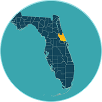
Volusia County, Florida has an area of 1,432 square miles, encompassing 16 cities and an estimated population of 564,840 based on ESRI data for 2022.
The county is bordered on the west by the St. Johns River, and by the Atlantic Ocean to the east. With a shoreline of 47 miles, roughly the size of Rhode Island, Volusia County is about 25 miles northeast of Orlando, 30 miles north of the Kennedy Space Center, 90 miles south of Jacksonville and 250 miles from Miami. Picturesque DeLand is the county seat and Daytona Beach is known for as the “World’s Most Famous Beach” and home to NASCAR.
Climate
Volusia County has on average 229 sunny days per year while the U.S. average is 205 sunny days. The hottest month in Volusia County is August with an average maximum temperature of 91°, average temperature is 82° and average minimum temperature is 75°
Source: https://beach-weather.com/Northern-America/United-States/Florida/Volusia-County/averages/
Weather and climate averages in the county as compared to the U.S.:
| Climate | Volusia, Florida | United States |
|---|---|---|
| Rainfall | 52.0 in. | 38.1 in. |
| Snowfall | 0.0 in. | 27.8 in. |
| Precipitation | 117.8 days | 106.2 days |
| Sunny | 229 days | 205 days |
| Avg. July High | 90.8° | 85.8° |
| Avg. January Low | 47.1° | 21.7° |
| Comfort Index (higher=better) | 7.1 | 7 |
| UV Index | 6.4 | 4.3 |
| Elevation | 26 ft. | 2443 ft. |
Source: https://www.bestplaces.net/climate/county/florida/volusia last update: 09/2021
